Economics From AFAR (Funded by Google)
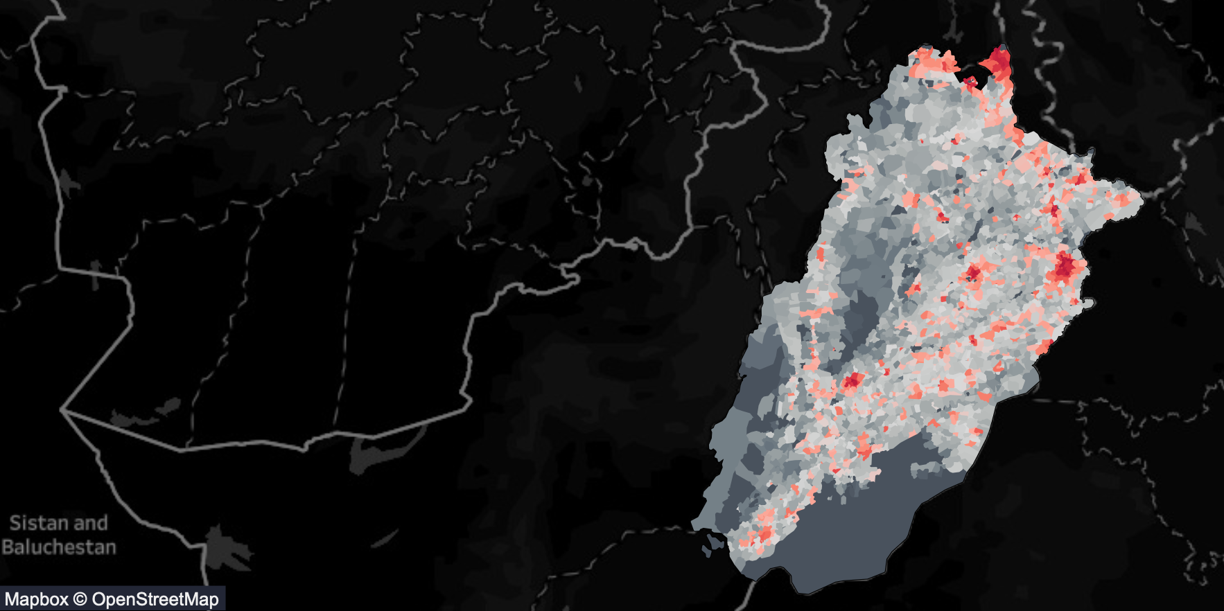
We at ITU are studying satellite and aerial imagery to develop tools that will assist Government and Non-Government organization in analyzing urban population, road structure, urban and rural structural development, agricultural regions, animal migrations and destruction caused by natural disasters.